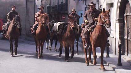
with foot, with horse or in VTC: more than 250 km of 3, hiking trail GR. in the vicinity immediate of the hirings
 Arrow
route of Cavaillon with Forcalquier Association law 1901 such: (0)4
92 79 05 82
Arrow
route of Cavaillon with Forcalquier Association law 1901 such: (0)4
92 79 05 82
Paths marked out accessible to all as to most sporting bordering the Durance and Bléone offered to the hikers.
Country of La Motte-Turriers - Bayons: starting from the Lake Esparron, Peak of Monges (2115 m), climax of the country sisteronnais.
Around Sisteron : In 5 H, turn of the rock of the Baume to admire Sisteron, rock procession and visit of the Saint Dominique church, the Hole of the money, cave.
The valley of Jabron : northern slope of the Mountain of Lure, offering many routes by the mule tracks, discovered given up villages, caves of Peyrourets.
Around Digne-les-Bains : Cousson, the bar of Dourbes, Solid mass of the Three Evêchés, bells of BarIes, throats of Trévans.
vault Jean saint : with ChâteauArnoux, 666 m alt., table of orientation. Walk with foot or in the car. Panorama on the valley of the Durance. Paths of river with mountain of the Stopover, Malijai, Peyruis, Volonne with Peipin.
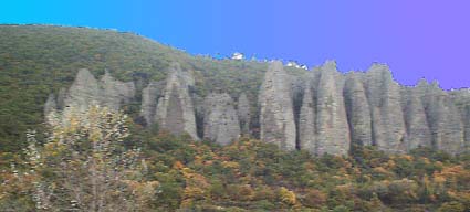 Les
Mées : Rocks
of the Penitent ones. Path marked out starting from the tourist
surface.
Les
Mées : Rocks
of the Penitent ones. Path marked out starting from the tourist
surface.
Around Manosque : Forest of Pélicier, in the Regional Natural reserve of Luberon, and other paths marked out around Manosque.
Oraison : Many pedestrian paths towards Puimichel and to the lake.